
Page 2 - SUFALAM
P. 2
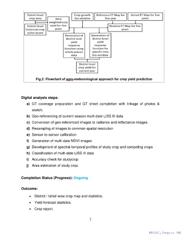
Digital analysis steps:

                   a)  GT  coverage  preparation  and  GT  sheet  completion  with  linkage  of  photos  &
                       sketch.

                   b)  Geo-referencing of current season multi-date LISS III data
                   c)  Conversion of geo-referenced images to radiance and reflectance images.

                   d)  Resampling of images to common spatial resolution

                   e)  Sensor-to-sensor calibration
                   f)  Generation of multi-date NDVI images

                   g)  Development of spectral-temporal profiles of study crop and competing crops
                   h)  Classification of multi-date LISS III data

                   i)  Accuracy check for studycrop

                   j)  Area estimation of study crop.


               Completion Status (Progress): Ongoing


               Outcome:

                     •  District / tahsil wise crop map and statistics.

                     •  Yield forecast statistics.

                     •  Crop report.


                                                              2


                                                                                                      MRSAC,Nagpur ©®
                                                                                                      MRSAC,Nagpur ©®