
Page 6 - NUIS
P. 6
\
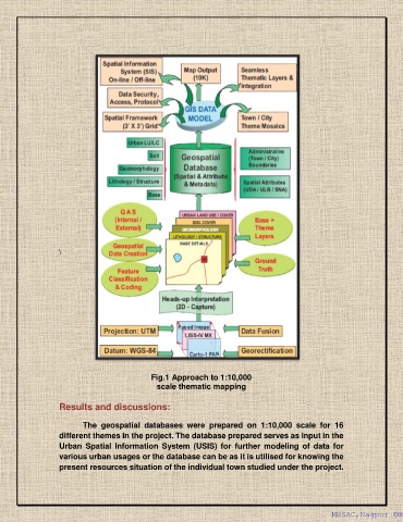
Fig.1 Approach to 1:10,000
scale thematic mapping
Results and discussions:
The geospatial databases were prepared on 1:10,000 scale for 16
different themes in the project. The database prepared serves as input in the
Urban Spatial Information System (USIS) for further modeling of data for
various urban usages or the database can be as it is utilised for knowing the
present resources situation of the individual town studied under the project.
MRSAC,Nagpur ©®
MRSAC,Nagpur ©®